Fargo / Moorhead Area
Dunton LocksLength: 2 miles
Trail Type: Wide Mow Path, W/ Partial Single Track Worn In Technicality: Low Exertion: Low Pets: OK Directions: Head south from Detroit Lakes, MN of Highway 59. About 2.5 miles down take a left at a sign for Dunton Locks.
These trails follow the paths of winter xc ski trails and thus are wide mowed paths, although single track width paths have been partially warn into the grass. Multiple laps could provide a workout but probably not worth the drive unless you are from the area.
|
View Dunton Locks Bike Trails in a larger map |
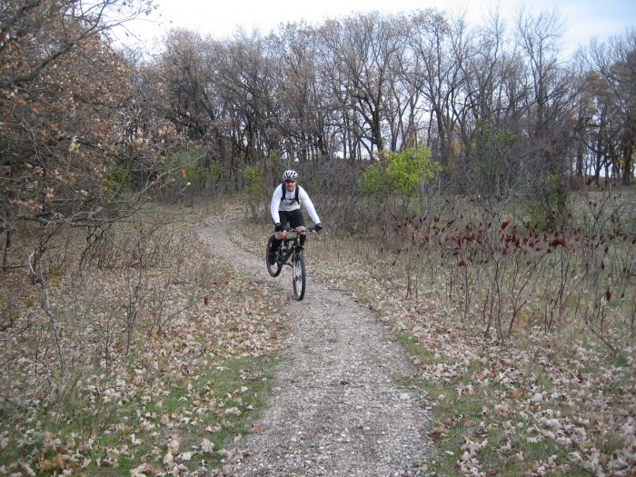
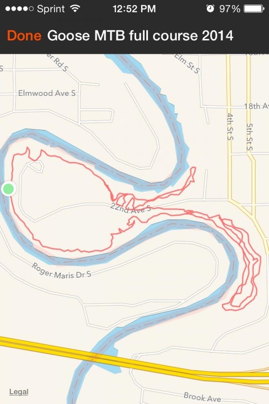
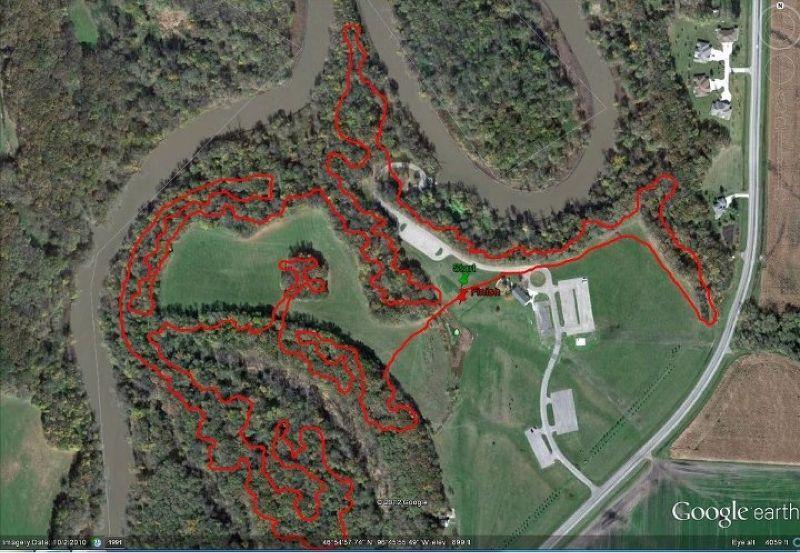
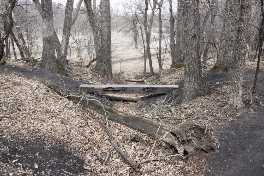
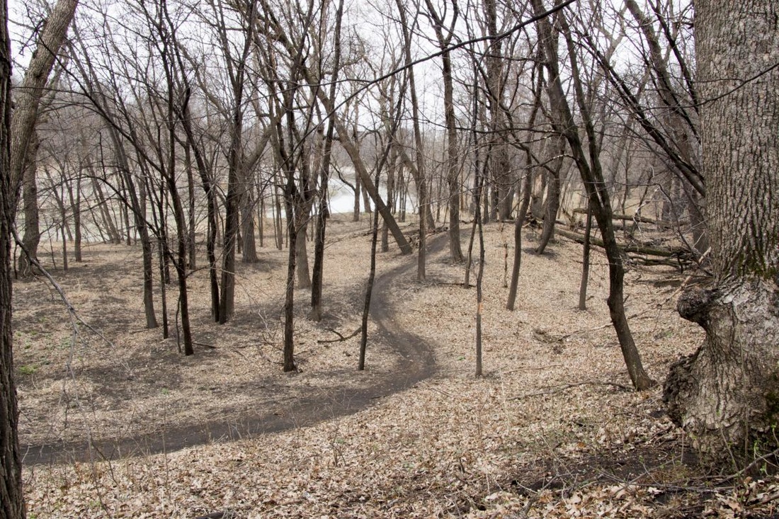
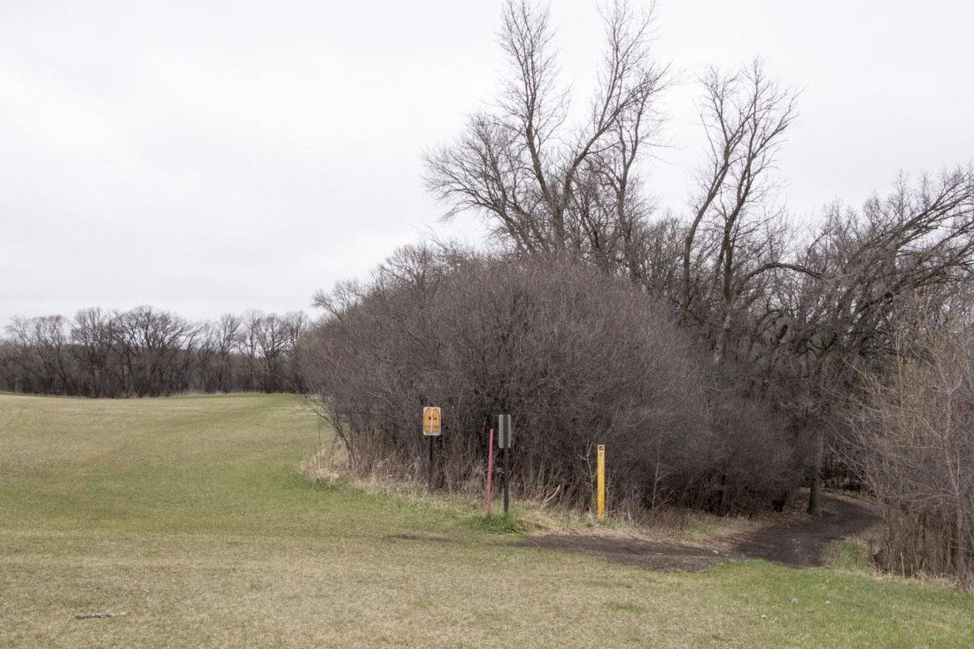
Gooseberry ParkLength: 4 miles
Trail Type: 75% Singletrack, 25% Doubletrack Technicality: Moderate, Fast With Some Wood Features Exertion: Moderate Pets: OK Directions: Take Highway 75 north from I94, left on 20th ave, left on 4th st, right on 22nd ave. Ends into park with multiple parking options.
This is great newer bit of singletrack in the Fargo area. Shorter length may call for a few laps, but the smooth fast trail and various wood features along the way keep things interesting. Take a long lunch and check it out. Trail uses seasonal flood area so Spring can be hit and miss with flooding and thick mud. The trail is also likely to change a bit year to year.
|
|


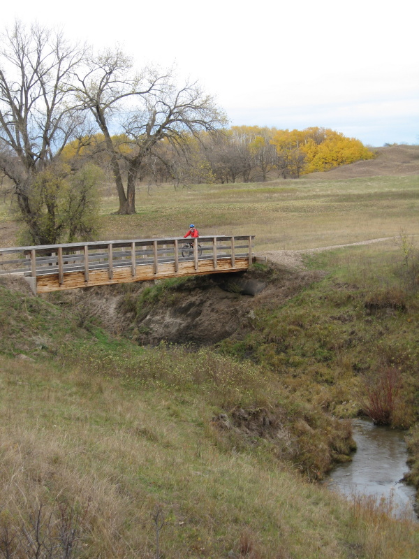
Hankinson Hills (Sheyenne National Grasslands)Length: 8 miles
Trail Type: Singletrack Technicality: Moderate Exertion: Moderate, Lots of Short Climbs & Descents Pets: OK Directions: Not the easiest to find. Take I-29 south from Fargo, ND. Take the Hankinson, ND exit and head West passing through Hankinson on Highway #11. Just past town take a right on County #166 (just past the welcome to Hankinson sign). When #166 ends at a tee take a left and again when the road either takes a 90 to the right or crosses a cattle guard, cross the cattle guard. You are now in the grasslands area. Follow the main road to the right and you will come around and see the campground passing one trail crossing along the way.
This is a nice flowing single track trail with a very nice almost unused campground. You may see some horse riders but will probably be on your own. Worth the drive, check this forgotten area out.
|
View Hankinson Hills Bike Trail Hankinson North Dakota in a larger map |
MaplelagLength: 10 miles and growing (5 miles singletrack)
Trail Type: 50% Singletrack, 50% Doubletrack Technicality: Moderate, Some Steep Climbs & Tight Fast Descents Exertion: Moderate Pets: Not Allowed Map: Maplelag Map Location: Little Sugar Bush Lake, Callaway, MN. Visit www.maplelag.com for directions and further information.
This is great little location and shows what a hard working family can create. The resort is privately owned and operated with a key focus on recreational use. There is a very nice resort and event facility and many miles of xc ski and single track mountain bike trail. The trail is well designed and constantly maintained. Bike and ski race events are held here annually. Well worth your time.
|
View Maplelag Bike & Ski Trails in a larger map |


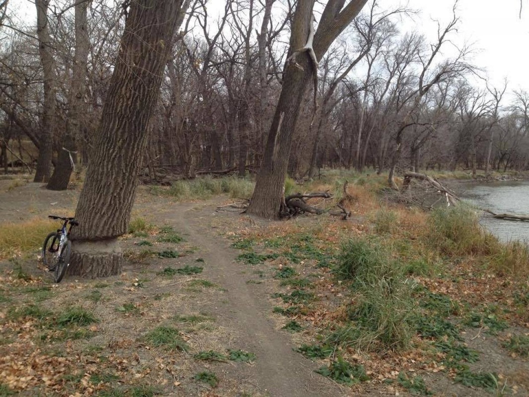
Mb Johnson ParkLength: 4 miles
Trail Type: 50% Singletrack, 50% Doubletrack Technicality: Low, Some Off Camber Corners And Plank Bridges Exertion: Moderate Pets: OK Directions: Take Highway 75 north from I94, left on 28th ave just pst the wastewater treetment plant then right at the tee on 11th st. Park on the left along the river.
This is great central location if your in the Fargo area. Great place to go pump out a few high pace laps and put some mile between you and that work project when time is tight. Trail is in seasonal flood area so Spring can be hit and miss with flooding and thick mud. The trail is also likely to change a bit year to year. Bike trail is scarce in the area and this is a reasonable place to stay sane close to home.
|
|
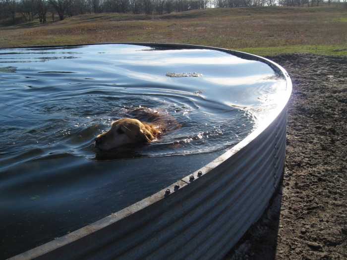
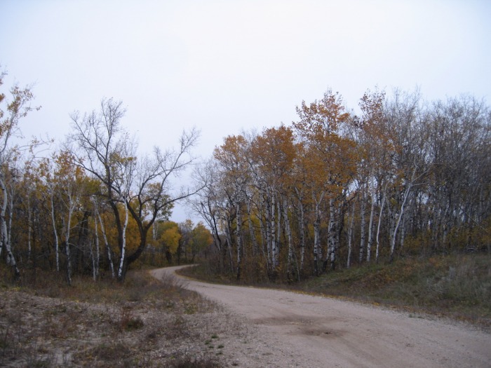
North Country Trail (Sheyenne National Grasslands)Length: 25 miles
Trail Type: Wide Singletrack (Dirt/Sand/Gravel) Technicality: Low, Wide and Gently Maneuvering Exertion: Medium, Good Surfacing But Long Ride Pets: OK, Don't Harass Cattle Map: USDA Map Directions: Head south from Fargo, ND on I-29. Take exit 48 and head west on ND-46. Turn left onto #18, then right on #2, then finally left onto #23. The trail head will be on your right between 2 and 3 miles south down #23.
This is a great trail, offering length for seasoned riders in a gentle high quality trail that the hole family will love. Views are good, and the locals are great. Take a day and enjoy. Can be ridden out and back or as a shuttled through trip. Bring lots of water for yourselves but we generally found enough water for the dogs in cattle troughs and streams. I have posted a .pdf of the USDA map that shoes the trail here. (USDA Map)
|
View Sheyenne National Grasslands (North Country Trail) in a larger map |