Bismarck / Mandan Area
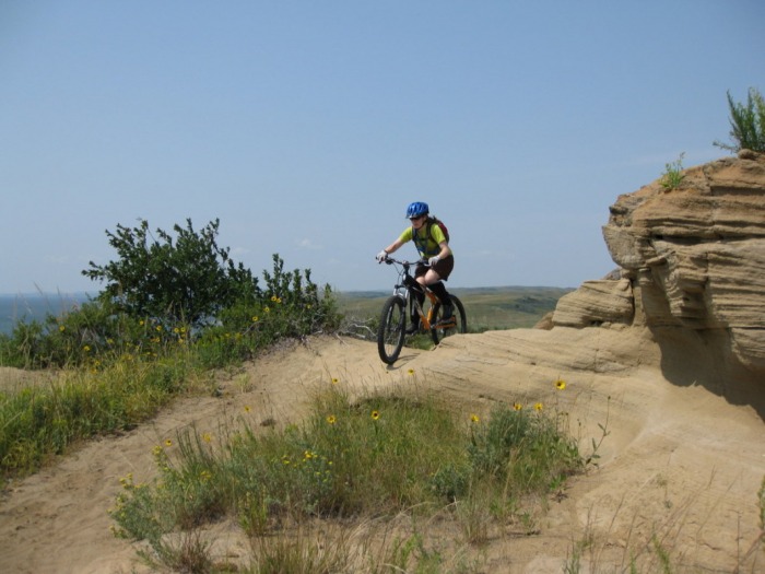
Adventist Academy TrailLength: 14 miles
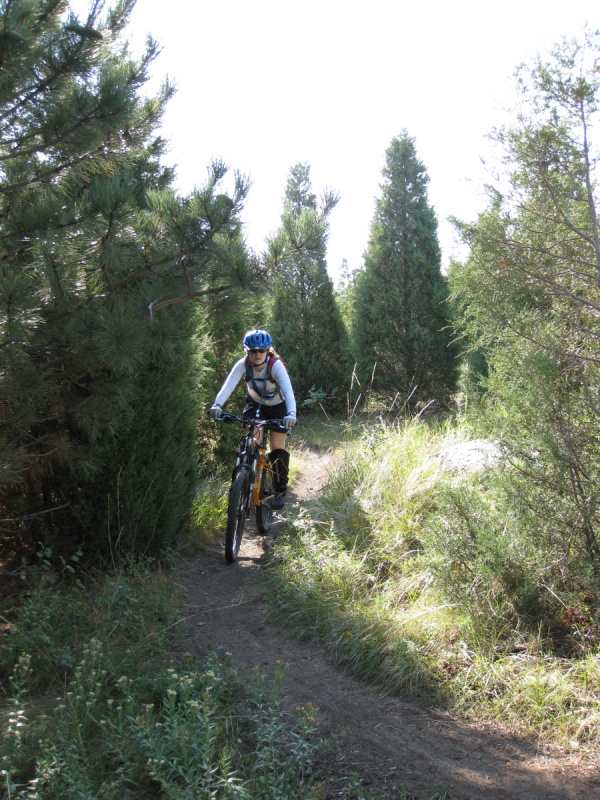
Trail Type: Tight Singletrack Technicality: Moderate W/ Six Walkable Bridge Type Stunts Exertion: Advanced, 14 Miles Of Bumpy Single Track Pets: Not Recommended Directions: Follow hwy 1804/83 north from Bismarck. Turn left at 71st Ave NE to and continue on hwy 1804 for a total of about 15 miles. You will pass the main Adventist Academy entrance on you right. The trail head and parking are in a group of trees a 1/2 mile past the main entrance.
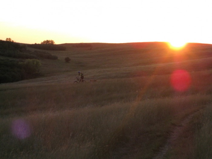
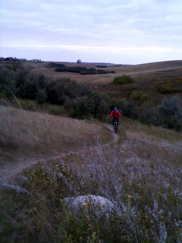
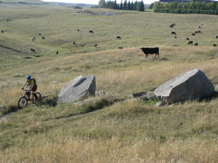
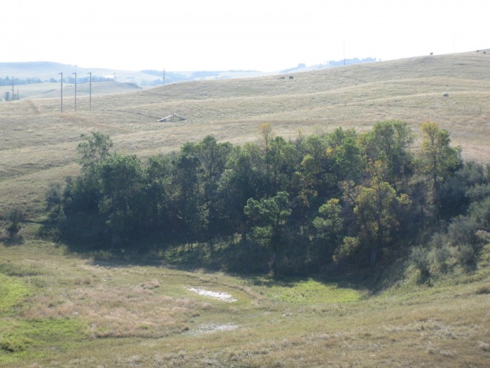
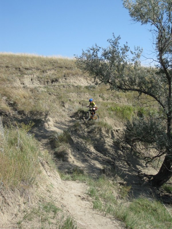
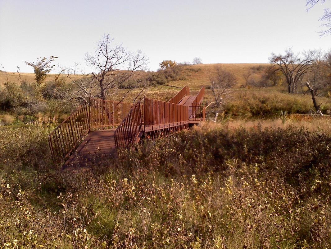
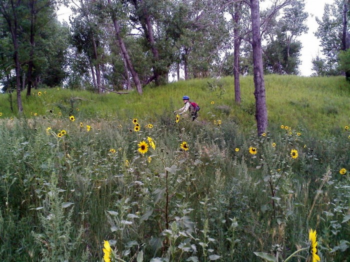
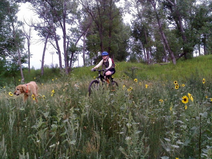
Probably Bismarck's best secret. This long singletrack is looped like a tapeworm into the grounds around the Adventists Academy. It utilizes steep embankments and natural ridges well creating a trail full of moderate climbs and wrist numbing descents. Much of the land is actively grazed by cattle so please respect these animals and the land. It is a great privilege to have access to this wonderful private stash. While the trail is not particularly steep or rocky, it is bumpy and includes short stretches of steep side hilling, with large drop-offs as well as half a dozen bridge like stunts for crossing over fences and creeks. Trail can be ridden in either direction to mix things up.
|
View Adventist Academy Trail in a larger map |

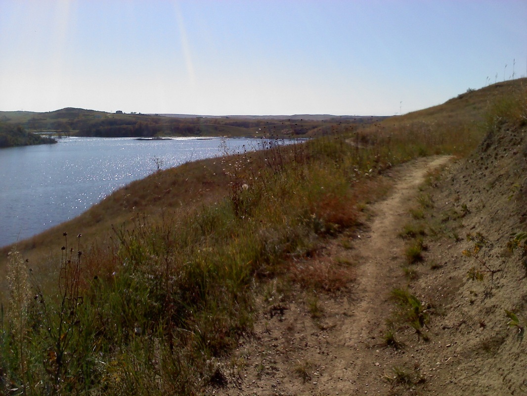
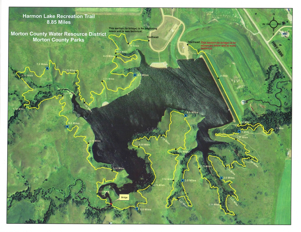
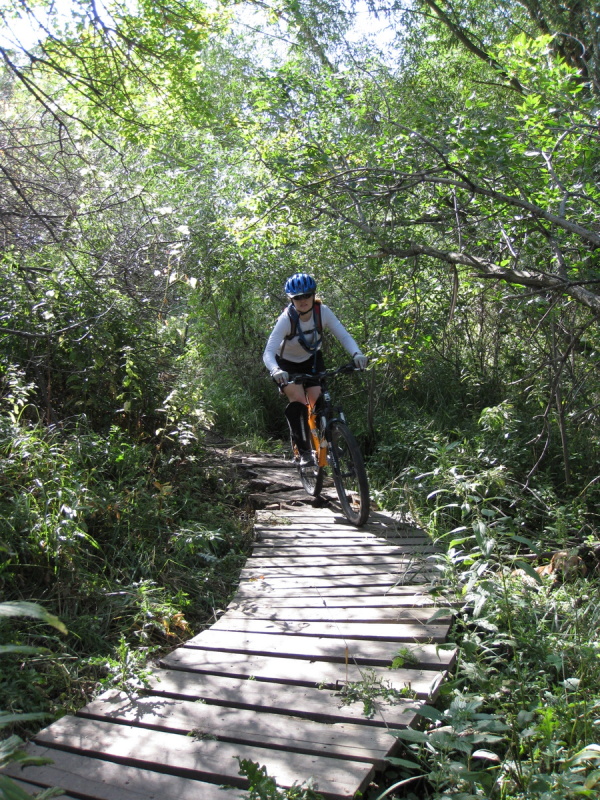
Harmon Lake TrailLength: 9 miles
Trail Type: Tight Singletrack Technicality: Easy (West Side)- Medium (East Side) Exertion: Medium Pets: OK Map: (Harmon Lake Trail Map, Park Opening Statement 2009) Directions: Take exit 153 off I-94 and head toward N Dakota 1806. Turn right at Mandan Ave, Slight left on Old Red Trail/Township Rd 105 and turn right at N Dakota 1806. Follow 1806 for about 8.5 miles and turn left at 32nd St. (you will see a housing development on the right) Take immediate left and follow into parking area. Total distance is about 11 miles from Mandan.
This is the newest addition to Bismarck area riding and is a treat. Note that the Google satellite images may not even show the lake, however rest assured that it has been in existence since 2009. The trail is divided into two sections with the area West of the parking area and bridge designed to be on the easier side and the area to the East on the harder side exhibiting a much bumpier, winding surface with numerous drop-offs on the lake side of the trail. Enjoy!
|
View Harmon Lake Bike Trail, North Dakota in a larger map |
Indian Hills (Nux-Baa-Gaa) TrailLength: 3.5 miles
Trail Type: Wide Singletrack Technicality: Low Exertion: Low, Gentle Climbs, Nice Packed and Smooth Trail Pets: OK Map (Nux-Baa-Gaa Trail Map) Directions: Follow US Hwy 83 70 miles north from Bismarck, ND. Turn left on ND-1804 and continue another 35 miles. Following signs for the Indian Hills Resort turn left on 70th Ave NW, and continue two miles. Turn left again following signs and when you come to the boat launch parking lot bear right and proceed to the far end of the Western wing of the camp ground. Park here, the trail leaves the end of the road next to a small cabin.
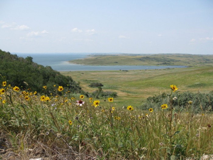
Nice beginners trail with nice views of lake Sakakawea.
|
View Indian Hills (Nux-Baa-Gaa) Bike Trail North Dakota in a larger map |

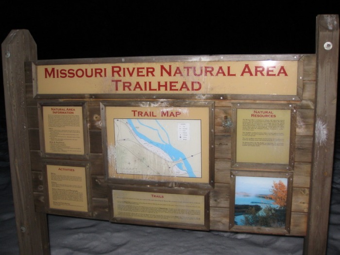
Missouri River Natural Area TrailLength: 5 miles
Trail Type: Abandoned Dirt Road & Double Track Technicality: Low, Wide And Predominantly Level Trail Exertion: Low, Great Beginner Biking Pets: Great, Lots Of River Access Directions: Take the Mandan Ave. exit from I-94 and turn south. Take the first available left just before some storage buildings, cross the railroad tracks and take a second left at the tee. Proceed back under the interstate now headed north and turn immediately onto a small dirt road that parallels the North side of I-94. Park at the end of the road and enjoy.
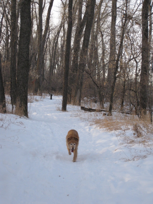
This is a great local trail. It serves the Bismarck/Mandan areas animal lovers a great service acting like an over-sized dog park. In years past it was groomed for XC skiing during the winter months, but although the grooming has abated it now provides a prime location for a quick ski or bike with your favorite four legged friends.
|
View Missouri River Natural Area Trail in a larger map |

Pioneer Park TrailLength: 4 miles
Trail Type: Tight Singletrack Technicality: Medium, Several Short Steep Climbs & One Walkable Bridge. Exertion: Moderate, Nice Packed and Smooth Trail Pets: OK Directions: Located on the bluff above the Bismarck, ND side of the Missouri River where it is crossed by I-94. There are many ways to access this trail. You can park at the Indian villages parking on the north end (leave parking area and follow paved trail down to first hard right...trails leave to left in trees before corner), behind Bismarck State College next to the football field on the East side (trail runs along edge of the street to the north and again west), at the Keel Boat City Park (trail drops under the I-94 overpass going in both directions joining the north and south sections of trail)
This is a great local trail. Most of the trail is well maintained although it can be a little confusing the first time. There are numerous hill climb trails that cross the main trail, but if you just follow the flow and ignore the crossings you will be fine. Lots of fun climbing and rolling side hilling with a great view. Gets late afternoon light making it a great sunset ride.
|
View Pioneer Park Trail in a larger map |

Scout's Trail (Ft. Abraham Lincoln State Park) Scout's Trail
Length: 5 miles
Trail Type: Wide/Medium Singletrack Technicality: Easy, Gently Climbing Widely Cut Trail Exertion: Easy, Nice Wide Packed and Smooth Trail Pets: OK, Leash Law Directions: Follow state park signs taking 6th Ave. Se (State 1806) south out of Mandan, ND. Turn left off highway and enter park (fee area). Proceed about 1 mile past the entrance booth and when you see the Indian village huts on and fence on your right turn left toward the blockhouse. Park at the Valley Picnic Area almost imediatly on your right. Trail leaves parking area on the North side and is well marked with maps at most junctions. See park map at http://www.parkrec.nd.gov/parks/falsp/FALSPmaps.pdf This is a very nice wide trail. Its smooth fast banked corners make it very fun to ride fast as an experienced rider, while its gentle climbs and wide single track cut make it a great beginner ride for the hole family. |
View Scout's Bike Trail (Ft. Abraham Lincoln State Park) Bismarck North Dakota in a larger map |
Sleepy Hollow TrailLength: 3.5 Miles
Trail Type: Medium Single Track Technicality: Easy W/ One Walkable Boardwalk Section Exertion: Moderate, Nice Packed and Smooth Trail Pets: OK Directions: Located on the 2000 block of East Divide Ave. in Bismarck, ND. Enter through main gates and park in parking lot immediately on right hand side. The trail can be seen passing the North and West sides of the parking lot through the grass and circles the park.
Short and fast loop, located conveniently in the middle of Bismarck. Great local ride when time is tight. Several laps provide a great release from life in the office in a location you can probably ride to. Group ride location most Mondays around 6pm.
|
View Sleepy Hollow Park in a larger map |
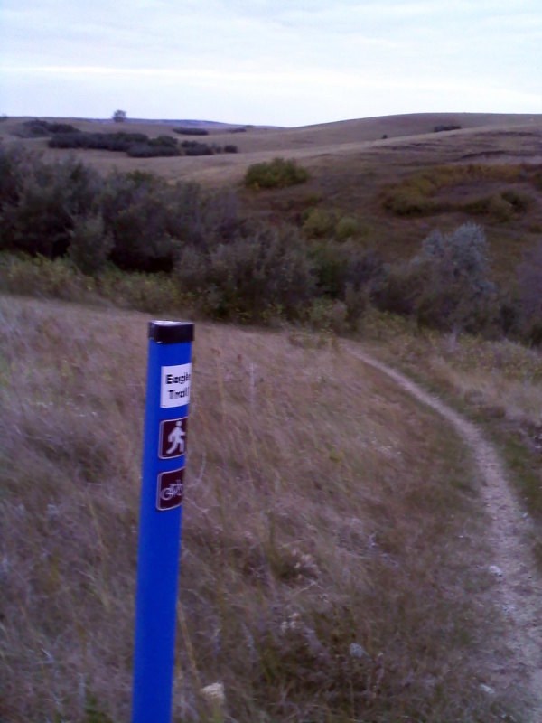
Sunset Park Trail (Eagle Trail)Length: 4 miles
Trail Type: Medium Singletrack Technicality: Medium, Several Short Steep Climbs & One Walkable Boardwalk Section. Exertion: Moderate, Nice Packed and Smooth Trail Pets: OK Directions: Located off of Sunset Drive South of the interstate and behind Louis and Clark Elementary School in Mandan, ND. Park next to the skate park and you will see the trail looping out through the grass left of the paved trail that heads north from the parking lot. Follow trail north west along the edge of the trees. The trail is a loop.
Short and fast but fun loop, winds through a Frisbee golf course while traversing the 80 acre park. Easily accessed on the west side of Mandan, ND this park is very pet friendly and offers the most technical intown trail in the area. Several laps provide a very relaxing afternoon.
|
View Sunset Park Bike Trail Bismarck North Dakota in a larger map |